KsINS-nano fiber optic strapdown inertial navigation system
product description:
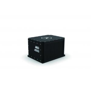
KsINS-nano optical fiber strapdown inertial navigation system is a miniaturized universal inertial navigation system using high precision fiber optic gyro and quartz flexible accelerometer. The product adopts compact design.
The system can be sensitive to the angular and linear motion of the UAV carrier, and output the position, speed, heading, angular rate, and linear acceleration information of the carrier in real time. It can be combined with a satellite receiver to complete integrated navigation operations, which can meet the needs of various UAVs. Attitude control, navigation and positioning requirements.

Features:
● Small size, light weight, high precision, good production technology and high reliability
● Rich communication interfaces
● The output protocol is flexible and can be configured through test software
● Vibration reduction accessories are provided to meet the needs of harsh vibration environments
● Have a complete BIT strategy and passed the actual flight assessment
Application fields and application modes:
It has been maturely used in the fields of high-altitude airships, rotary-wing UAVs, and fixed-wing UAVs.
Performance indicators :
| Align time | ≤5min |
| Position accuracy | Pure inertia: 2nmile/h (CEP); integrated navigation with satellite: altitude 10m; horizontal 5m |
| Speed accuracy | In integrated navigation mode: sky speed ≤ 0.2m/s, horizontal speed ≤ 0.1m/s |
| heading alignment accuracy | ≤ 0.1° (1σ) (self-aligned) |
| Heading maintenance accuracy | 0.02° /h (pure inertia), 0.03° (integrated navigation) |
| Attitude alignment accuracy | 0.02°(1σ) |
| Attitude maintenance accuracy | 0.03° (pure inertia), 0.02° (integrated navigation) |
Application environment :
| Working/storage temperature(℃) | -40℃ ~+60℃ /-45℃ ~+80℃ |
| MTBF(h) | 30000h |
| Dynamic Range | Angular velocity: ±300°/s; acceleration: -25g~25g |
| Mechanical properties | Endurance shock environment: half sine wave 20g, 11ms, Endurance Vibration Environment: 1. No shock absorption: GJB150.16A-2009 Figure C.3 Rear peak sawtooth wave 2. With shock absorption: GJB1032 random vibration spectrum |
Physical properties:
| Dimensions | 175mm×140mm×110mm |
| weight | ≤ 3.6kg |
| waterproof level | IP67 |
External Interface:
| powered by | 18V~36V DC |
| Power consumption | ≤ 15W |
| Input/output interface | RS-422×2 (multiplexing), RS-232×3 (multiplexing), CAN×2 network port×1, Pulse interface × 2, data storage 8G |
| Data output frequency | ≤1000Hz |